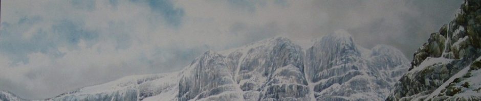
Today I am off to Glenmore Lodge for a working group on Mountain Accidents, it is a group hopefully that may be able to assist in getting the Safety message across after a sad winter. It will be interesting to see what comes up? I think we must keep trying to improve the Safety message. I also commented on the “fight on Everest” there are some interesting comments on the UK Climbing Forum, many arguing their case. Some of it makes very ugly reading. Whatever happened and only these who were involved know it is a sad day for mountaineering. My trip in 2001 to Everest in our own small trip was a wonderful experience. It was to Tibet on the North side, I was the Base camp Manager and managed at the end of the trip to get to the North Col. No one else was on the mountain, all the other trips had gone home after a huge Storm. The rest of my team were at Base camp 4000 feet below. As the only European left and it was an incredible feeling, the place was deserted and we had this wonderful place to ourselves. I started to take a big load down from the North Col down the battered fixed ropes to help our Sherpas as they were clearing the mountain. There was no way they would let me help, it was there job and the only let me carry a couple of oxygen bottles down. I had 5 days alone with them and we already had a bond but it was some experience. They looked after me in way only they can, we became great friends and treated each other with huge respect. I find it very upsetting to hear of this trouble on Everest, where one Sherpa has already died on the ice -fall fixing the ropes, I pray that it gets sorted out and all can work together with these wonderful people.

Working as equals is the way to a happy Expedition – our hut being given to the local Tibetans after our expedition in 2001. Though our expedition was in Tibet all expedition were mainly staffed by Sherpas the workhorse of most trips. Russell Brice the main operator now on the South side would be involved in trying to sort out the problems this year.

Andrew Bachell, SNH director of operations, said:
“Wild land is an incredibly valuable asset for Scotland. It makes an important contribution to our tourism industry and images of wild places also help support Scotland’s world wide reputation as a beautiful and impressive country. It makes a crucial contribution to our quality of life and we know that most Scots consider wild places to be important to them. Wild land also supports biodiversity and is often associated with our most impressive wildlife.
“Like all natural assets this resource must be managed sensitively if it is to be sustained. Our new map will enable planners and developers to take account of wild land, particularly in planning future windfarm and any other large scale developments. We wish to share this map as widely as possible with stakeholders, particularly in the context of the Scottish Government’s consultation on its third National Planning Framework and Scottish Planning Policy.”
The 43 areas, and their size in hectares, are:
1 Merrick 7,858.06
2 Talla – Hart Fells 9,170.58
3 Broad – Dollar – Black Laws 9,883.32
4 North Arran 11,751.05
5 Waterhead Moor – Muirshiel 4,670.10
6 Jura, Scarba Lunga and Garvellachs 28,420.57
7 Ben Lui – Beinn Ime 16,050.60
8 Ben More – Ben Ledi 24,247.20
9 Upper Almond 26,772.37
10 Loch Etive mountains 51,564.76
11 Breadalbane – Schiehallion 45,500.27
12 Lyon – Lochay 7,345.77
13 Ben Lawers 8,142.69
14 Rannoch – Nevis – Mamores – Alder 119,653.62
15 Cairngorms 157,996.16
16 Lochnagar – Mount Keen 57,211.78
17 Monadhliath 82,868.78
18 Moidart – Ardgour 39,918.13
19 Knoydart – Morar 81,231.17
20 Rum 4,229.91
21 Kinlochhourn – Glen Quoich 24,319.19
22 Cuillin 17,132.05
23 Duirinish 4,505.89
24 Central Highlands 129,020.10
25 Applecross 11,934.43
26 Coulin & Ledgowan Forest 20,549.98
27 Flowerdale – Shieldaig – Torridon 31,745.86
28 Fisherfield – Letterewe – Fannichs 81,250.29
29 Rhiddoroch – Beinn Dearg – Ben Wyvis 91,529.68
30 Inverpolly – Glencanisp 20,544.22
31 Quinag 10,534.50
32 Reay – Cassley 57,179.99
33 Foinaven – Ben Hee 56,201.17
34 Cape Wrath 22,635.36
35 Ben Hope – Ben Loyal 21,652.25
36 Ben Klibreck – Armine Forest 53,154.50
37 Causeymire -Knockfin Flows 53,313.86
38 East Halladale Flows 15,898.88
39 Hoy 5,481.52
40 Ronas Hill & North Roe 5,235.74
41 Harris – Uig hills 44,221.41
42 Eishken 16,335.80
43 South Uist hills 10,164.53

Dave,
Scottish Government recently issued its National Planning Framework 3 ‘main issues report’ for consultation (as you say), and I’d urge anyone who thinks the same as you and I do about windfarms to respond. The questionnaire on which you can do so is at this link at the bottom (one questionnaire for NPF3 and one for SPP)
http://www.scotland.gov.uk/Topics/Built-Environment/planning/NPF3-SPP-Review
What they’re proposing is better than nothing. Now if they would just designate a 75 mile exclusion zone around each of the National Scenic Areas – that’s around about the distance I could see from the summit of Cairn Gorm of the beautiful crisp winters day I experienced in mid-January 2012 – and remove all windfarms already without that zone, then they’d be getting somewhere. But somehow I don’t think that’s going to happen.
In some ways, it is too late. But as I say, it’s better than nothing.
I’ll keep fighting.
David
LikeLike
Never give up David.
LikeLike
Appreciate you comments, I will put a précis in my blog over the weekend, the fight continues..
LikeLike